Share
The Earliest Settlers of Northwest Sussex Co, DE and Their Lands 1673-1800 Vol 1: Present Day Northwest Fork and Nanticoke Hundreds
William Collison
(Author)
·
John R. Williamson
(Author)
·
Createspace Independent Publishing Platform
· Paperback
The Earliest Settlers of Northwest Sussex Co, DE and Their Lands 1673-1800 Vol 1: Present Day Northwest Fork and Nanticoke Hundreds - Collison, William ; Williamson, John R.
Choose the list to add your product or create one New List
✓ Product added successfully to the Wishlist.
Go to My Wishlists
Origin: U.S.A.
(Import costs included in the price)
It will be shipped from our warehouse between
Monday, June 17 and
Wednesday, July 03.
You will receive it anywhere in United Kingdom between 1 and 3 business days after shipment.
Synopsis "The Earliest Settlers of Northwest Sussex Co, DE and Their Lands 1673-1800 Vol 1: Present Day Northwest Fork and Nanticoke Hundreds"
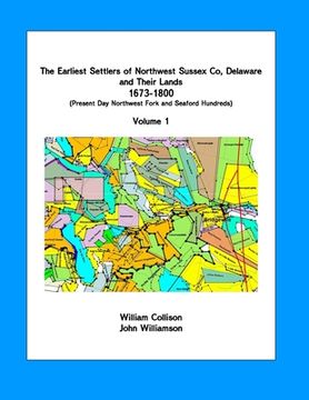
This is Vol 1 of a two volume book (BOTH VOLUMES NEED TO BE PURCHASED TOGETHER. Please see Vol 2 listed separately.). The books summarize research that was done to identify all the original land patents in northwest Sussex Co, Delaware from 1673-1800, to identify their original owners and to provide a chronological history of the land until 1800. The area involved is the area north and west of the Nanticoke River in Delaware to the Delaware/Maryland state line. Prior to the Mason-Dixon Line, this area was considered part of Dorchester County, Maryland. The book was developed as a land record reference book for genealogist researching this area. For genealogy researchers who have wondered where their ancestors lands were in this area, the book has plotted all original tracts on modern day maps. Other information developed from the early land records includes: a map of early roads in the area; a map of early landing places on the Nanticoke River, a map of mill locations, and a map of rivers with colonial day names and a table showing present day names. Vol 1 includes a series of 14 maps of the area of research placed in grid maps. In Vol 2 there is a description of every land tract identified and identification as to which map in Vol 1 the land is on and the grid location.
- 0% (0)
- 0% (0)
- 0% (0)
- 0% (0)
- 0% (0)
All books in our catalog are Original.
The book is written in English.
The binding of this edition is Paperback.
✓ Producto agregado correctamente al carro, Ir a Pagar.

